
In my youth, I always loved the times when my dad would let me sit in the front seat during road trips. Not only was there ample leg room for a change, but I was also able to take charge of the map. It was amazing to me how that compact rectangle of paper, designed to fit in a glove box, could unfold to reveal our whole state, and how, with a bit of practice, I was able to not only pinpoint our location but also track our progress and estimate our time of arrival.
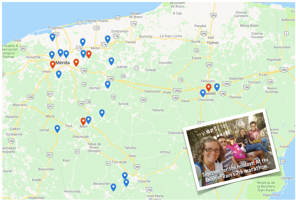
Long gone are the days of navigation by paper maps. Still, maps, like the one above can be useful to measure the progress that we’re making toward our destination. In this case, the destination that we’re seeking is the goal of filling the Yucatán with churches.
On this map, each pin represents a new church being planted by workers who have walked through our 12-month church planting process. The red pins represent the communities where we are holding special outreaches in the month of February designed to accelerate the growth of these new churches.
Would you take a moment this month to pray for all of our church planters and especially for the planned outreaches? If you have a bit more time, why not head over to our interactive Google Map @ https://s1.ag.org/churchmap where you’ll be able to click on each pin to reveal the names of our church planters and prayer requests associated with each work.
Thanks for your prayers!

Tags: Church planting, Evangelism

